Deep in the mountains of the Los Padres National Forest near Santa Barbara is a long and dusty backpacking trail that leads to Sespe Hot Springs. Because this trail requires at least one day of hiking in warm, exposed conditions, most people do not visit or even know about Sespe. Yet, for those brave enough to make the trek, these are worthwhile springs for any LA-based backpacker.
Sespe Hot Springs Near Santa Barbara
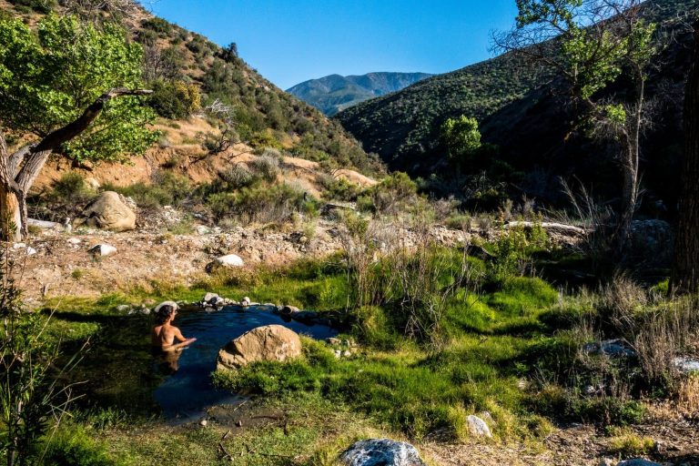
Sespe is truly a hidden gem. The springs are approximately 50 miles east of Santa Barbara and 21 miles north of Ojai, California. These remote hot springs are in a rock-walled pool with water averaging 105°F degrees.
To hike the most popular trail, you’ll drive a quiet highway from Ojai then a remote forest road to the trailhead for Sespe Hot Springs. Sespe is ideal for a fall, spring, or winter visit when the weather is mild. Summer daytime temperatures on the trail can reach or exceed 100° degrees Fahrenheit.
Sespe is not easily accessible. Getting to the hot springs requires a long, strenuous day hike or, ideally, an overnight backpacking trip. If you want a shorter walk, you can visit the Montecito Hot Springs or take a shorter, 20-mile overnight hike to Willett Hot Springs.
Seasonal Access Information
Because of the exposure and desert conditions, the best time to visit Sespe Hot Springs is in the spring and fall. Winter brings rainstorms, and summer brings heat waves. Due to the chance of extreme weather, it’s best to check your daily forecast before you visit the hot springs.
The busiest and best time to visit Sespe is in the spring, between March and early June. During these weeks, the grass is green, and wildflowers begin to bloom. Spring daytime temperatures average 55°F to 70°F, and nights can drop as low as 40°F. The river will be full after the winter’s rains which brings a risk of flash flooding, so expect many challenging water crossings. However, you’ll also have a beautiful experience at the hot springs.
The second best time to visit Sespe is in the fall, between mid-October and early December, when the daytime temperatures are still 60°F to 70°F. In the fall, night temperatures may drop to freezing, and there are occasional days of wind and rain. These months are also the driest, so your wildfire risk increases. As a result, campfires are not allowed. Regardless, autumn is an excellent time to visit these hot springs when you can enjoy mild daytime weather and cool nights relaxing in the natural mineral pools.
If the summer or winter is the only season you can visit Sespe, plan your route, and bring a satellite communication device for safety. In the summer, avoid hiking during the hottest hours.
Camping in the Sespe Wilderness
If you hike from the Piedra Blanca trailhead along the Sespe River Trail, the most popular trail to the hot springs, you’ll walk past four wilderness campsites: Bear Creek, Oak Flat, Willett, and Coltrell Flat. All camps are free and first-come, first-serve.
Bear Creek is five miles from the trailhead and has swimming holes and shaded campsites. The Oak Flat campground is two miles past Bear Creek, which features another swimming hole, tree-covered campsites, and even a picnic table. Willet is at the ten-mile mark on the trail and is close to another natural hot spring in a raised metal tub. Finally, Coltrell Flat is the fourth and last campground before Sespe Hot Springs and is at the 14-mile mark approximately.
As this is the wilderness, some backpackers may choose to camp anywhere off the trail if they observe trail etiquette and don’t light campfires between late spring and early winter (small camp stoves are allowed with permits). Remember to filter your water, poop in the woods, and take out your trash.
Nudity and Hot Springs
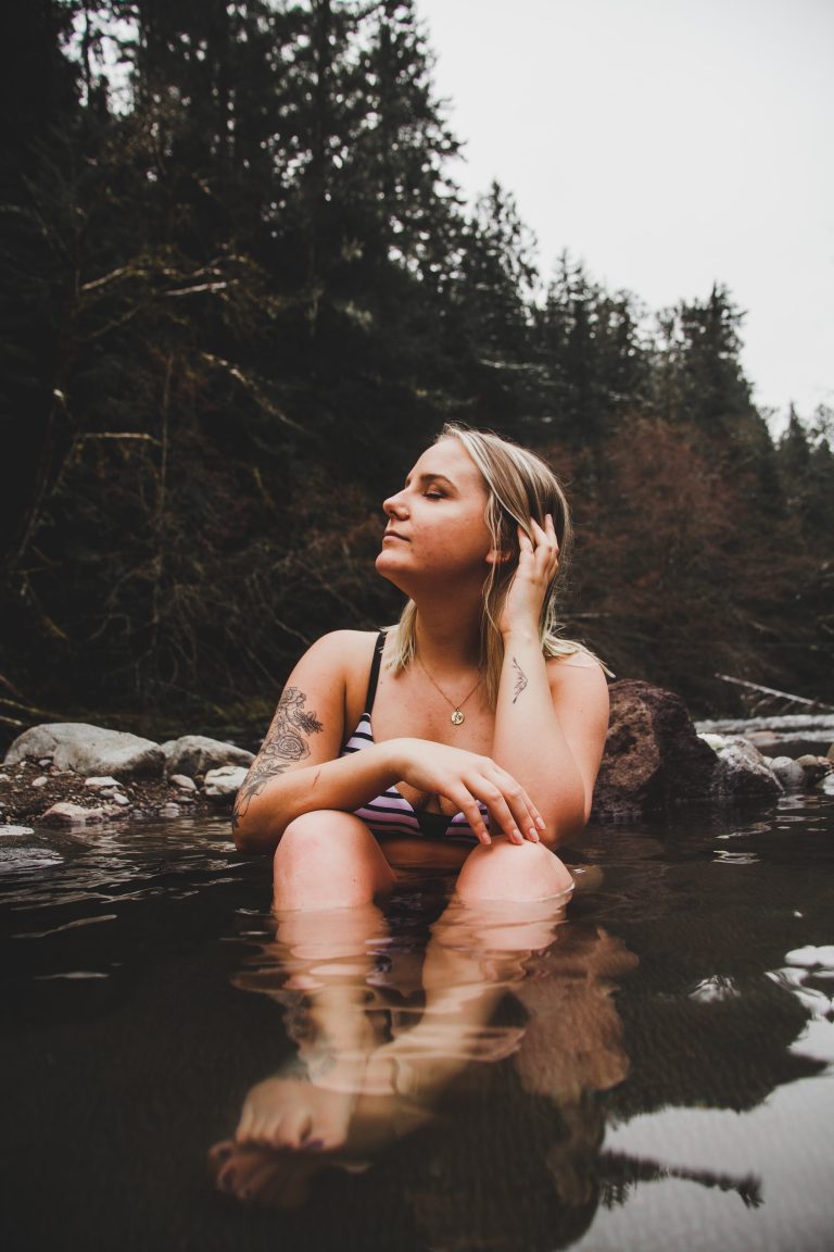
Just as you may expect at other hot springs, there may be nudity at Sespe Hot Springs. However, there is also a chance you won’t see anyone, so there is no need for swimsuits regardless. View all clothing-optional hot springs in California.
Directions to Sespe Hot Springs
The best way to get to Sespe Hot Springs is from Southern California. Northern California visitors will have a six-hour drive, while Southern California visitors will drive for just two hours.
Driving Directions to Both Trailheads
- Driving to Johnston Ridge Trail: This trailhead is 100 miles northwest of Los Angeles and will take two and a half hours of driving. From LA, go on the 5 North freeway until you reach Frazier Park (exit 205). Turn left onto Frazier Mountain Park Road and drive for seven miles before turning left on Lockwood Valley Road. On Lockwood Valley, drive for 10.5 miles before turning left on Forest Route 7N03/Grade Valley Road. After 10.8 miles on Grade Valley, turn left, and the trailhead will be on your right.
Directions: Google Maps route from Los Angeles and San Francisco (about 350 miles and six hours of driving). - Driving to Sespe River Trail: This trailhead is 100 miles northwest of Los Angeles and will take about two hours of driving. Go on the 101 North freeway from LA until you reach Ventura, then take the 33 North freeway towards Ojai. After driving approximately 26 miles on the 33 North, turn right on Forest Route 6N31/Rose Valley Road/Sespe River Road. Follow that road for about five miles before you arrive at the Piedra Blanca trailhead.
Directions: Google Maps route from Los Angeles and San Francisco (about 350 miles and six hours of driving).
Hiking Directions From Both Trailheads
There are three hikes to Sespe Hot Springs, with the two most accessible trails below. Johnston Ridge Trail is shorter, less-visited, and has fewer campsites. Sespe River Trail is the most visited trail and has multiple campsites and water sources. It is recommended only experienced backpackers take this route. Don’t forget to pick up a copy of the National Geographic Los Padres National Forest East map ($15).
- Johnston Ridge Trail (20W12): This less-visited trail is approximately 9 miles one-way, and over 16 miles round trip to the hot springs. Start hiking at the Johnston Ridge trailhead and walk three miles before the trail drops into the Hot Springs Canyon. Around 8.5 miles after the trailhead, you’ll take a side trail to Sespe Hot Springs. You can walk this trail in one long day or a one or two-night backpacking trip.
See more: Trail description (U.S. Forest Service), trail description (Hike Los Padres), and Google Maps route. - Sespe River Trail (20W13): This trail is approximately 15 to 17 miles one-way and over 30 miles round trip to the hot springs. The trail almost entirely follows the Sespe River. Start hiking at the Piedra Blanca trailhead and walk four miles along the river to the first campground, Bear Creek. The first dependable water source is at nearby Kerr Springs, so bring a filter if you need to refill water here. From there, walk another three miles to the Oak Flat campground. From Oak Flat, hike to Willett campground, then the Coltrell Flat campground. Coltrell Flats is where you turn left (north) onto Trail 20W12. The final trek is two miles along the Hot Springs Canyon. Many hikers backpack this for two to four nights.
See more: Trail description (U.S. Forest Service) and Google Maps route.
Shorter trail alternative: Hike to Willett Hot Springs, 20 miles out and back.
Map
View Statewide California Hot Springs Map
Sespe Hot Springs Soak Stats
Season: Spring, Fall, Winter
Type: Backpack
GPS (Hot Springs): 34.59863778723511, -118.99949955077533
Federal Land: Los Padres National Forest; Sespe Wilderness
Elevation: 2,600 Feet (792 Meters)
Parking Fees: Yes per day or purchase an annual Adventure Pass per car
Usage: Moderate
Fire Restrictions: May through December
Hot Spring Temperatures: Between 105°F (40°C) to 130°F (54°C)
Area Features: Ojai, Mt Pinos, Hungry Valley State Recreation
Nearby Hot Springs: Gaviota, Willett, Hot Springs Canyon, Avila, Sycamore, Ecotopia
Closest Gas and Food to Johnston Ridge Trail: Frazier Park, CA
Closest Gas and Food to Sespe River Trail: Ojai, CA
Bugs: Moderate
Red Spider Mites Reported: Yes
Backcountry Camping: Bear Creek, Oak Flat, Willett, and Coltrell Flat
Dogs: Yes, on leash
Clothing-Optional: Yes
Pit Toilet: Yes, at the Piedra Blanca and Johnston Ridge trailheads
Santa Clarita
California
93252
United States
